
Reaching the Highest Peaks in Costa Rica
Pictured above: Cerro Chirripo
Several of Costa Rica’s highest mountain peaks retain the name they were given by native Americans. They were an integral part of indegenous cultures, revered by the civilizations who lived here for millenia. Let’s hope the human race can continue to show reverence for Mother Nature, including these five spectacular summits listed in descending order of altitude.
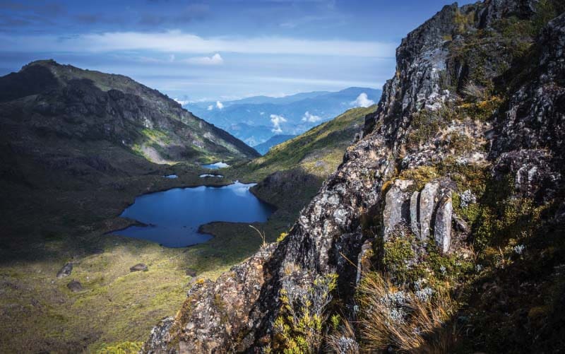
1. Cerro Chirripo
Standing atop Cerro Chirripo Grande on a clear day, you can see the Carribean Ocean some 40 miles to the east. And from the same vantage point you can spot the Pacific Ocean on the western horizon, about 35 miles from the mountaintop.
At an altitude surpassing 3,800 meters (just over 12,600 feet), Chirripo is Costa Rica’s highest peak. Getting there begins with a 10-mile hike from the town of San Gerardo de Rivas to the ranger station in La Amistad International Park. Then comes another three-mile trek to the peak.
Chirripo harbors five ecosystems, including the primary cloud forest — “cloud islands” — at the topmost level. The weather station there records hail several times a year, but no snow has occurred in the last century. Stories of snow being common in an earlier age are now perceived largely as folklore. The mountain’s native American name chirripo translates as “land of many waters.”
2. Cerro Ventisqueros
Costa Rica’s second highest peak is Cerro Ventisqueros, with an elevation just 30 meters shorter than its neighboring “big brother” Chirripo. Most hikers opt for the latter towering peak, so Ventisquero is much less frequented. Some consider this an ideal reason to visit Ventisqueros, even stating a preference for the “little brother” view.
Permits are required from the Ventisqueros ranger station, where blankets are rented for one dollar a day. Night temperatures can dip below the freezing point on the peak, with a terrain that has been compared to Andean elevations. Below the treeline (3,000 meters), tapirs are commonly seen and the bird life, including quetzals and the endangered harpy eagle, is spectacular.
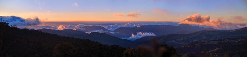
Panoramic view of Cerro de la Muerta
Kamuk mountain trips are for serious naturalists.
3. Cerro Kamuk
Approximately 60 kilometers due south, near the Costa Rica/Panama border, is Cerro Kamuk, a mountain named by the indigenous Bribri people who still inhabit this forest in La Amistad International Park. Standing almost exactly 300 meters shorter than Chirripo, Kamuk is the third highest peak in Costa Rica.
Plan to spend four days on hiking trails that are constantly overgrown with brush to reach the top of Kamuk, which means “place of rest.” Traversing more than a dozen lower peaks along the way, the average daily hike takes about eight hours.
The area is home to several large cat species including the jaguar. It also harbors dozens of different varieties of mushrooms. With Kamuk’s density of biodiverse species unmatched by any similarly sized conservation area in the world, visitors are required to be accompanied by a certified guide. Precautions to preserve this fragile ecosystem include the use of only new hiking equipment, ensuring that no foreign spores, mildew and micro-organisms are introduced. In short, Kamuk mountain trips are for serious naturalists.
4. Cerro de la Muerta
The Talamanca mountain range became separated from its neighboring elevated areas by a tectonic uplift. The result is an endemic ecosystem that resembles Andean plant and animal species. The highest Talamanca peak is Cerro de la Muerta, translated as “Summit of Death,” an appropriate name at one time. In the early 20th century, crossing by horseback or on foot from the Central Valley took three or four days. To accommodate travelers along the way, when temperatures commonly drop below freezing, cabins were constructed in 1908.
History can be a cruel mistress but Cerro de la Muerta has since been tamed. Construction of the Pan-American Highway has made it possible to access the fourth highest spot in Costa Rica by hiking less than a mile up a well-maintained trail. From a marked sign on the paved road, the path gently ascends only 100 meters along the way. It’s a favorite area for amateur ornithologists to see an array of avian species including the timberline wren, the peg-billed finch and the famed quetzal. The Orosi River is a popular trout fishing spot.
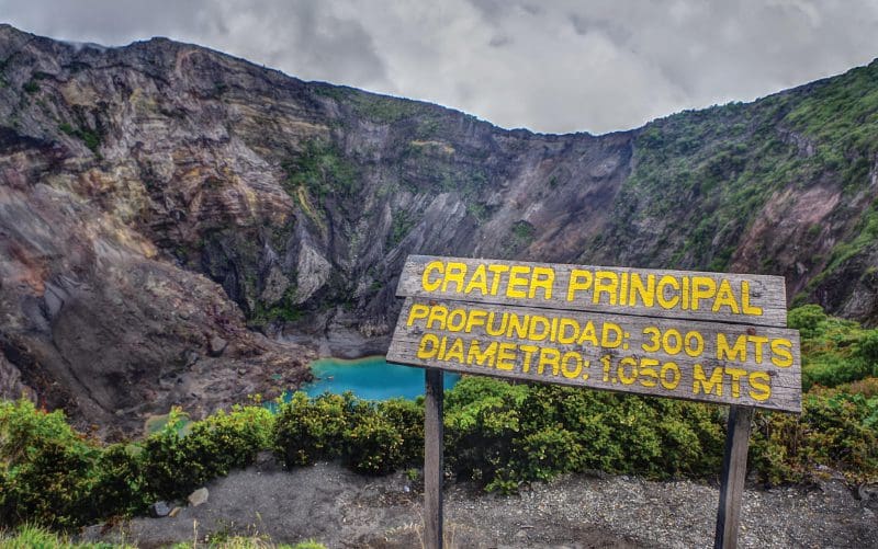
Volcan Irazu, Cartago
5. Volcan Irazú
The fifth highest peak on our list happens to be Costa Rica’s tallest active volcano, Irazú, reaching 3,440 meters (about 11,000 feet) high. Located in the Cordillera Central, near the city of Cartago, Volcan Irazú actually contains several craters at its summit. Most notably, Diego de la Haya holds a green crater lake whose depth varies according to rainfall levels.
Irazú Volcano National Park is home to the armadillo, fox, owl, woodpecker and a variety of hummingbirds. There is now a road leading right up to the summit craters, making the volcano a popular tourist attraction. Since 1723, Irazú has erupted at least 23 times, on average every 13 years. The last recorded eruption occurred on December 8, 1994.
Rincon de la Vieja – Things to do
4×4 Lake Arenal – road to El Castillo
Lucky Lovers Leap into an adventure of a lifetime
Lake Arenal – Lost Canyon Adventure
Gone Fishing: worst day fishing beats the best day working
Seven Days in Costa Rica: Arenal, Dominical and More
Lake Arenal: Safari River Float is a slow boat to paradise
Gone Sailing in Guanacaste Costa Rica
Cocos Island, Costa Rica’s treasure
Stand Up Paddle boarding SUP
ATV Tours, Take the road not taken
Deep Sea Fishing, Fun and Flamingo Costa Rica
White water rafting in Costa Rica
Scuba Diving in Costa Rica
Costa Rica Combo Adventure Parks
Authentic Costa Rica: What to do in rural Bijagua
Blue River Resort and Hot Springs