There’s a specific sound that tells you Guanacaste is in its dry-season mood. Not birdsong. Not howler monkeys. It’s the constant thump-scrape of tree branches getting a stern lecture from the wind, plus that familiar rattle of windows that makes you check—once again—that you really did close them properly.
If you’re anywhere near Costa Rica’s north Pacific between late autumn and early spring, chances are you’ll meet the Papagayo winds. They arrive like an uninvited guest with excellent timing: the sky is blue, the roads are dusty, the sunsets are ridiculous… and the breeze is strong enough to rearrange your patio furniture into modern art.
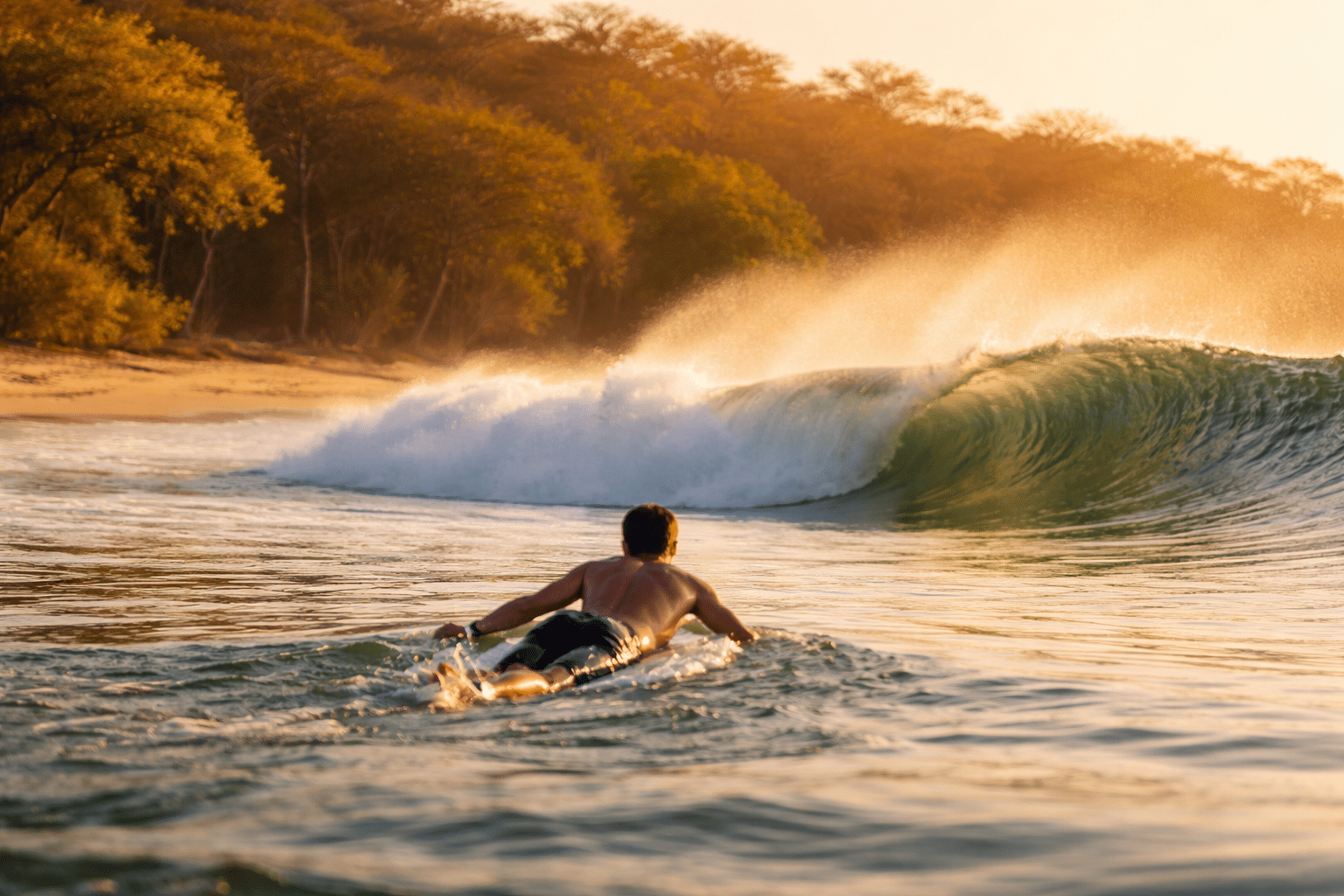
And if you surf, these winds can turn a decent swell into a clean, glossy, postcard-perfect session.
What is Costa Rica’s dry season, and why does it feel so windy in Guanacaste?
Costa Rica’s dry season on the Pacific side generally runs from about December through April, and Guanacaste often feels extra windy because the Papagayo winds are most common during the Northern Hemisphere winter. aoml.noaa.gov+1
Dry season in Guanacaste isn’t just “less rain.” It’s bright mornings, lower humidity, and that steady sense that the landscape has switched to its golden-brown palette. Then the wind shows up and adds attitude—especially in open areas, coastal plains, and anywhere a gap in the mountains lets air funnel through.
What are the Papagayo winds (also called the Papagayo Jet)?
The Papagayo winds are strong gap winds that push from the Caribbean side toward the Pacific, funnelling through lower-elevation corridors near Lake Nicaragua and blasting out over the Gulf of Papagayo. en.wikipedia.org+1
Locals and surfers call them “Papagayos,” but in meteorology you’ll often see “Papagayo Jet.” Same character, same punch. These winds can be intense enough that reports commonly cite peaks around 70 mph on the strongest days. Witch’s Rock Surf Camp+1
When do the Papagayo winds happen in Costa Rica?
Papagayo wind events are most frequent in the Northern Hemisphere winter months, often showing up from roughly November into March (and sometimes stretching toward April depending on conditions). aoml.noaa.gov+1
If you’re planning a trip and want to experience them (or avoid them), keep these quick rules in mind:
-
Most likely season: late November to March
-
Peak feel: mid-winter, when cold air outbreaks up north are stronger en.wikipedia.org+1
-
Pattern: they can arrive in bursts that last days, then relax, then return en.wikipedia.org
Why do storms in the US and Canada affect wind in Costa Rica?
Cold, high-pressure air masses moving south from North America can strengthen pressure differences across the region, and that pressure gradient helps drive gap winds that spill toward the Pacific. en.wikipedia.org+1
In plain terms: when it gets properly wintry up north, the atmosphere shoves colder, denser air into places where it can “escape” southward. Central America’s mountain chains don’t let that air stroll across evenly—so it gets squeezed through lower passes, like water forced through a nozzle. The result is faster wind, concentrated in specific corridors.
Meteorologists group this family of winds with other famous gap-wind systems, including the Tehuantepec winds in Mexico and the Panama jet. en.wikipedia.org+2oceancolor.gsfc.nasa.gov+2
Why are Papagayo winds so good for surfing on the Pacific coast?
Papagayo winds often blow offshore on the north Pacific coast, which can hold wave faces open longer and shape cleaner, more organised surf. Witch’s Rock Surf Camp
Surfers simplify wind into two categories because it really does change everything:
-
Offshore wind: blows from land out to sea, grooming the wave face and helping it stand up cleanly
-
Onshore wind: blows from sea toward land, roughening the surface and making waves crumble earlier
When Papagayos line up with swell, it can feel like someone turned on the “HD mode” for your session—crisper faces, tidier lines, and more makeable sections.
Why does the wind sometimes switch or fade during the day?
Daily heating and changing pressure differences can shift local winds, so some days start glassy then get breezier, while others stay offshore for hours. en.wikipedia.org
Even during a Papagayo pattern, you’ll notice variety:
-
Some mornings begin clean and light, then the wind builds.
-
Some days the wind is already humming at sunrise and doesn’t let up.
-
Some locations are sheltered and feel calm while a few kilometres away it’s blowing hard.
That’s why surfers in Guanacaste love checking both the forecast and the map: headlands, bays, and river mouths can change how wind hits a break.
Where in Guanacaste do you feel the Papagayos most?
The Papagayo influence is strongest across exposed areas of the north Pacific, especially around the Gulf of Papagayo region and other open-coast stretches where wind has a clean line of travel. en.wikipedia.org+1
You don’t need to be right in “Papagayo” to feel it. If you’re on the Nicoya Peninsula or the greater Guanacaste coastline, you’ll notice days when:
-
palms lean like they’re posing for a postcard,
-
beach sand starts exfoliating your legs,
-
and your hat becomes a migrating species.
Do Papagayo winds affect the ocean and marine life?
Yes—Papagayo wind bursts can trigger mixing and upwelling that cools surface waters and brings nutrients up, influencing productivity offshore. en.wikipedia.org+1
This isn’t just surfer trivia. Strong winds can change sea surface temperature and contribute to ocean features that support biodiversity in the eastern tropical Pacific. The knock-on effects can show up as:
-
cooler water patches,
-
increased nutrients near the surface,
-
and “busy” food-chain conditions that attract marine life. en.wikipedia.org+1
How can travellers handle Papagayo winds without getting wrecked by them?
You’ll enjoy windy season more if you plan for comfort and safety—especially for sun exposure, loose gear, and water activities. en.wikipedia.org+1
Quick, practical fixes:
-
Bring a light windbreaker (you’ll use it more than you expect at night).
-
Lock down your gear: towels, hats, and anything on balconies will try to escape.
-
Mind the ocean: wind can increase chop and make swims feel more demanding.
-
For surfers: favour more protected breaks if it’s howling, or embrace the offshore perfection if your spot can handle it.
FAQ: Papagayo Winds and Dry Season in Costa Rica
Are Papagayo winds the same as trade winds?
Not exactly—Papagayo events can be stronger and more concentrated because air is funnelled through a gap, creating a jet-like effect. en.wikipedia.org
Do Papagayo winds happen every day in dry season?
No, they usually come in episodes that can last several days, then ease before returning. en.wikipedia.org
How strong can Papagayo winds get?
On the strongest days, commonly cited peak speeds are around 70 mph, though many days are far more moderate. Witch’s Rock Surf Camp+1
Do Papagayo winds always create offshore surf?
Often, yes, on many north Pacific exposures—but local geography can bend wind direction and create exceptions.
Is January a good time to surf Guanacaste?
It can be excellent because dry season swell windows and offshore wind events can overlap, producing clean conditions. Witch’s Rock Surf Camp+1
Do the winds affect temperature?
They can make evenings feel cooler and can lower sea surface temperatures during stronger events due to mixing and upwelling. aoml.noaa.gov+1
JTNDaWZyYW1lJTIwd2lkdGglM0QlMjI2NTAlMjIlMjBoZWlnaHQlM0QlMjI0NTAlMjIlMjBzcmMlM0QlMjJodHRwcyUzQSUyRiUyRmVtYmVkLndpbmR5LmNvbSUyRmVtYmVkMi5odG1sJTNGbGF0JTNEMTAuNDMzJTI2bG9uJTNELTg1LjI2NSUyNmRldGFpbExhdCUzRDEwLjQzMyUyNmRldGFpbExvbiUzRC04NS4yNjUlMjZ3aWR0aCUzRDY1MCUyNmhlaWdodCUzRDQ1MCUyNnpvb20lM0Q1JTI2bGV2ZWwlM0RzdXJmYWNlJTI2b3ZlcmxheSUzRHdpbmQlMjZwcm9kdWN0JTNEZWNtd2YlMjZtZW51JTNEJTI2bWVzc2FnZSUzRCUyNm1hcmtlciUzRCUyNmNhbGVuZGFyJTNEbm93JTI2cHJlc3N1cmUlM0QlMjZ0eXBlJTNEbWFwJTI2bG9jYXRpb24lM0Rjb29yZGluYXRlcyUyNmRldGFpbCUzRCUyNm1ldHJpY1dpbmQlM0RkZWZhdWx0JTI2bWV0cmljVGVtcCUzRGRlZmF1bHQlMjZyYWRhclJhbmdlJTNELTElMjIlMjBmcmFtZWJvcmRlciUzRCUyMjAlMjIlM0UlM0MlMkZpZnJhbWUlM0U=


