
Papagayo Winds
It Must Be Dry Season in Costa Rica
As I sit here writing this article in the middle of January, powerful gusts of wind rattle the windows of my apartment, and the sound of falling branches on the roof above my head gives me a quick jolt every 10 minutes or so. Must be summertime in Guanacaste. And of course, I wish I was surfing.
The winds that sweep across the country between November and April in northern Guanacaste are known as the Papagayo winds. They can be quite impressive some days. Wind speeds have been recorded as high as 70 miles per hour, just shy of hurricane strength.
As most surfers know, these winds can be the ultimate blessing when there is swell in the water. The Papagayos blow across the country from east to west, and are known as offshore winds on the Pacific coast. In the surfing world, there are only two wind directions that really matter: offshore and onshore.
Just as the name suggests, offshore winds are those that blow off the shore. These winds act like a fine-toothed comb grooming the oncoming waves, holding the wave up longer and producing perfectly peeling tubes!
Onshore winds are just the opposite. They blow from the ocean to the shore and are not ideal for surfing. Blowing in the same direction of the waves, onshore winds cause a wave to prematurely break while inhibiting the wave’s ability to barrel.
How does it happen?
So what causes these impressive winds? Why does the wind turn onshore at 9 a.m. on some days, and other days howl offshore from sunrise to sundown?
To answer this question, we must remember that wind is nothing more than areas of high pressure flowing into areas of low pressure. Just as a river flows from high elevations to lower elevations, the air in a high-pressure system will “flow” downhill toward lower pressures.
Believe it or not, the Papagayo winds are a result of what is happening to our neighbors in the United States and Canada. During the winter months in the Northern Hemisphere, cold fronts (high pressure) carrying frigid Canadian air drop across the United States and move out the warm air (low pressure).
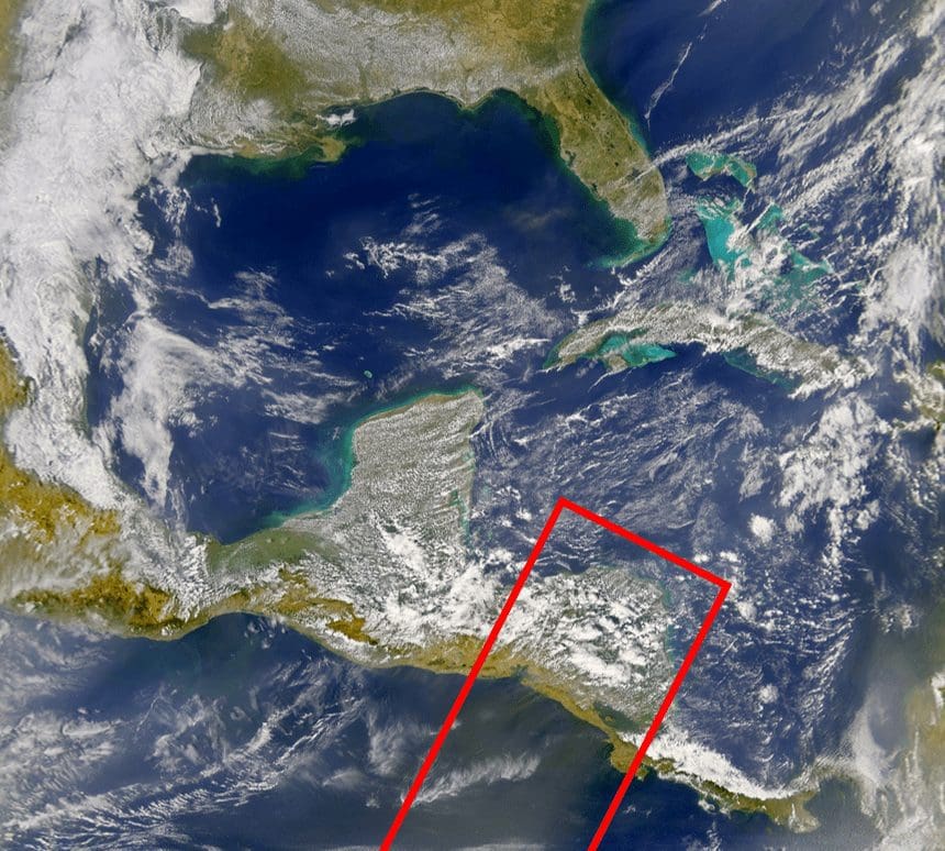
As the cold front (high pressure) dips over the Gulf of Mexico and the Caribbean, it looks for the easiest escape path towards the lower pressure over the Pacific. There are a few points along Mexico and Central America where the high pressure can escape. They include these three locations: Chivela Pass in Mexico, Lake Nicaragua in southern Nicaragua, and the Gaillard Cut in Panama where the Panama Canal is located.
It was only yesterday that my mom called me from Virginia Beach saying that Winter Storm Helena had dumped about six inches of snow in the area. Helena originated as a strong cold front that intensified along the east coast and left some pretty significant amounts of the white stuff in her path. Helena intensified into a nor’easter off the coast and sent a frigid northerly swell for exposed beaches.
So what have we learned from this? Basically, the next time you see our neighbors to the north preparing for their next Arctic blast, you can start planning your next all-day offshore surf day on Costa Rica’s Pacific coast.